


Saltbox Road and the Parklands Beyond the Railroad Tracks Saltbox Road is an abandoned road (to car traffic, anyway) that extends from Freedom Street a few hundred yards beyond the railroad crossing, up to Overdale Parkway. Originally it continued on to North Avenue in Mendon. In the top picture you can see the road, the yellow gate at the entrance, and a bit of Freedom Street on the right. It runs more or less parallel to Freedom Street, from behind the old dump to the intersection at Overdale Parkway. In recent decades that section of Freedom Street has often been referred to as Saltbox Road, and sometimes as Soapbox Road. In town records and the street listing books, an Old Salt Box Road is included up to present time. One house is shown as having 1 Old Salt Box Road as its address. It's the last house on the left, as you travel up Overdale Parkway. You'd think it would have an Overdale address, since Old Salt Box Road almost looks like its driveway. (photo below) As to the nearby section of Freedom Street, from behind the old dump to the Mendon line, Saltbox is evidently an informal thing, resulting from people attaching the name of the old dirt road to the newer paved road that replaced it. Town records wouldn't be calling a piece of Freedom Street by another name. Informal names that people tag onto things can be an entirely different matter. There has been quite a discussion on Facebook during the past couple of days (in July 2015) about whether the correct name is Saltbox or Soapbox. I'd say there's no doubt that the old dirt road is Saltbox. (Frank Dutcher, who knew a thing or two about Hopedale, wrote that it had gotten that name because there had been a family by the name of Dillon who had lived in a saltbox-style house along the road.) It may be that saltbox sounds close enough to soapbox that some started calling it by that name. Some commenting on Facebook thought there had once been soapbox derby races there. My guess is that the younger you are, the more likely it is that you call it Soapbox Road or Soapbox Hill.
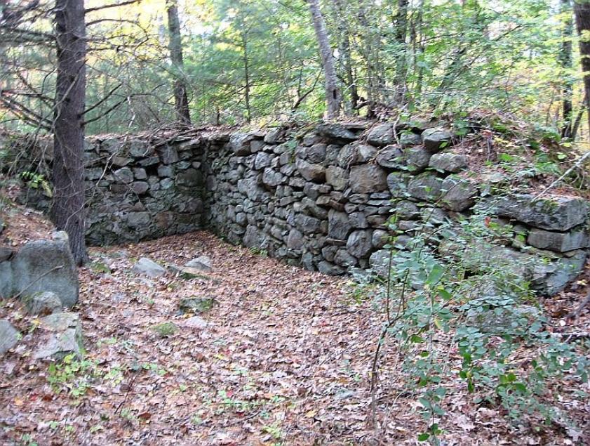
on Freedom Street, but not on the "Soapbox Hill" section of Freedom Street. The starting line was near the Oak/Freedom intersection and the finish line was at Dutcher Street. It's possible that kids made their own cars and raced down Soapbox Hill from time to time, but I'm sure there were never any formal races there. Click here for a page on the races. For most of its length, Saltbox Road looks much like what you see in the first three pictures near the top of the page. Stone walls run along most of it on both sides. The last hundred yards or so, as you get near Overdale Parkway, are overgrown. Several old foundations can be seen near the road. They're fairly close to each other, and I think at least one of them was probably for a barn. There are several paths that branch off of Saltbox Road. One of them leads to the fieldstone shelter called the Lookout. The bottom picture, which shows Hopedale Pond, was taken near the Lookout.
house in the area at the time it got the name. One of the fieldstone foundations shown on this page may have been the cellar of the saltbox house. Freedom Street at that time (during the days of the Hopedale Community - 1842 - 1856) went to Mendon, up the steep hill past the "Saltbox" place, now (1910) occupied by the Dillon family. Frank Dutcher, Hopedale Reminiscences. The Lookout Back to Parklands Walk, Page 1 Overdale Parkway |


The note here was written by Mendon historian Jane
Coleman. Thanks to Dick Grady for sending it.
Coleman. Thanks to Dick Grady for sending it.

It's interesting to see that this little clipping of the 1922 town directory shows that there was an occupied house on Saltbox (or Salt Box, as it's also spelled) Road. The last year Hapgood's name appears is 1925. For some years after that, I haven't found anyone listed as living on Salt Box. My guess is that the house was very old and in such poor condition that no one wanted it, and it was eventually razed or fell down on its own. In recent years one house is shown being on Old Salt Box Road. Possibly that's where the Hapgood home was. I've looked through the street listing books, but the fact that for many years the Overdale houses didn't have numbers adds to the difficulty of figuring what was where. |

I've included this clipping here because, according to Frank Dutcher, it was the Dillon saltbox-style house that gave Saltbox Road its name. The house may have stood on one of the foundations shown in pictures above. "Overlook" must refer to what's now called Overdale Parkway. I don't know if that's what it was called at one time, and later changed to Overdale, or more likely, it's a typo. |

1970
The saltbox originated in New England, and is an example of American colonial architecture. One theory holds that the saltbox form was popularized by Queen Anne's taxation of houses greater than one story. Since the rear of the roof descended to the height of a single-story building, the structure was exempt from the tax. More likely, though, the saltbox shape evolved organically from the need for additional space for growing families; adding a lean-to was an economical way to enlarge the house. The earliest saltbox houses were created when a lean-to addition was added onto the rear of the original house extending the roof line sometimes to less than six feet from ground level. Old weathered clapboards are still in place on parts of the original rear exterior walls of some of the earliest New England saltbox houses. The hand-riven oak clapboards on both the Comfort Starr House and Ephraim Hawley House are preserved in place in the attic that was created when the lean-to was added onto the original house. The style was popular for structures throughout the colonial period and into the early Republic, perhaps because of the simplicity of its design. |


The "winter pictures" were taken in December 2006. Those showing leaves on the trees are from September 2011 A path off of Saltbox Road leads to the dirt road that begins at the end of Overdale Parkway and ends at The Lookout. The picture above, looking down at Hopedale Pond, was taken from that road. |

A saltbox house. Evidently the one on Saltbox Road was of this style, but I'd think it was far smaller and probably quite rustic. Anyone farming that rocky hillside couldn't have afforded much of a house. |


Old Salt Box Road - 2015 |

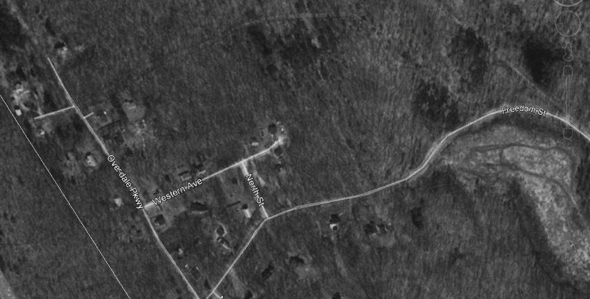
Below - Google Earth views of the Saltbox Road section of Freedom Street, and, faintly visible in this March 1995 view, the dirt road which was the original Saltbox Road. I've included one view with, and one without street lines and names. The Mendon town line is on the left, parallel to Overdale Parkway. |
The Lookout Back to Parklands Walk, Page 1 Overdale Parkway Caboose House on Overdale Parkway Park, Pond and Sports Menu HOME |
1970


Milford Daily News, June 25, 1985

HOPEDALE — Jennifer Moore takes her dogs into Hopedale’s 280-acre Parklands conservation land every day, year-round. “When we had those big snows, I put on my boots and broke the (fresh) snow walking around,” she said. Moore lives in her parents’ Overdale Parkway home, where the Hopedale High School graduate moved back for the duration of the pandemic. The paved section of Overdale Parkway ends just past the last house on the road, at which point it continues as a wide trail deep into the forest. Rules for the Parklands are listed on a large sign a short distance down the road. Used for decades by residents like Moore as the entrance to the Parklands, the woodland road and land to either side of it are now part of a local controversy. Hopedale resident Ricardo Lima, also a police officer in town, and Hopkinton-based Black Brook Realty are looking to build a total of 10 houses on either side of the unpaved road. Lawyers for the two entities asked selectmen last month to authorize a 1985 Town Meeting article they said would allow use of the road to access their lots and proposed new homes. The developer would pave the road under the new agreement. “The intent of the town is to have Parkland,” said Denise Linder, Moore’s mother, as she and a small group of residents walked up the path on Thursday. “You start to take that away, what are you doing to the town legacy?” Though lawyers for Lima and Black Brook Realty said the land on which they are looking to build is not Parklands — which is protected from development — and that they will be restricted to the 10 homes, Overdale Parkway residents disagree. “I think most people feel a little bit threatened,” Linder said. “You take an inch, put a house here, and next thing you know there’s 60 houses.” Moore, Linder and others produced stamped town records showing the area labeled as Parklands, old town reports saying the Park Department has jurisdiction over the land, and a typewritten letter from 1917 advising a park commissioner on how to make it obvious that the area is town-owned. A group of concerned residents meets virtually every week, Linder and fellow resident Joyce Lovewell said, and includes about 15 families from the neighborhood, as well as people from other sections of town. “It’s not strictly an issue for Overdale,” Linder said. On a nice day, 20 families might drive up and park at the dead end to use the trails, the group said, and Overdale Parkway residents like Moore use it all year. The cross country teams use it to get into the Parklands trails, Moore said. “Where are people going to park?” Lovewell asked. In addition to wanting to protect the Parklands, Overdale Parkway residents worry about possible contamination of their drinking water wells, and the availability of water for new homes. A previous attempt to develop the area proposed widening the road, which would have meant paving swaths of residents’ front yards. “The rationale might be revenue for the town,” Linder said, of approving the developers’ request and allowing the homes. “You’re not saving the budget on 10 homes. It’s not worth the risk.” Jennifer Moore, of Hopedale, stands on an unpaved road near her home on Overdale Parkway as she talks about growing up near the Parklands, Hopedale's conservation land, March 11, 2021. With her are her dogs, Buster and Dobby. Developers are looking to build a series of luxury homes between her neighborhood and the Parklands. Residents and a Park Commission member raised concerns about rights to the land at a meeting with selectmen last month, and selectmen requested a title search, which is ongoing. This is not the first time development has been proposed for the land, then opposed by residents. In 2000, a much larger development was planned, and residents prevailed in land court. Residents this past week pointed to other instances in their unearthed town documents in which the Park Commission in particular continued to assert its authority over the land and denied commercialization of any kind. “The frustrating thing is we already went through this,” Lovewell said, walking along the wooded path with Linder and her daughter. “It should be a non-issue at this point,” Linder agreed. Proposals for either Lima’s or Black Brook Realty’s developments would need approval from other town boards, in addition to securing the access road. Actual plans have not yet surfaced. Alison Bosma can be reached at 508-634-7582 or [email protected]. Find her on Twitter at @AlisonBosma. |

