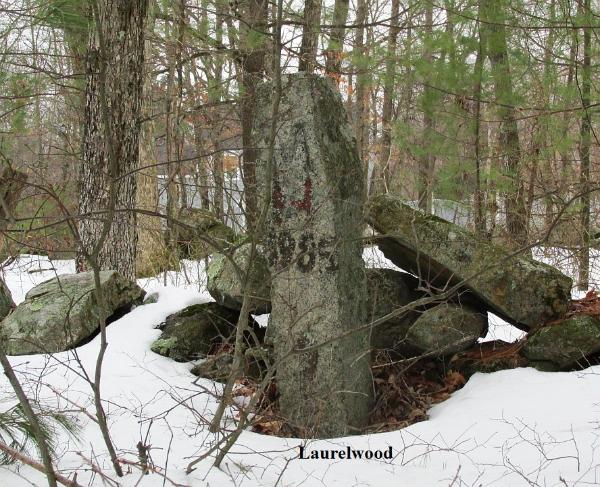
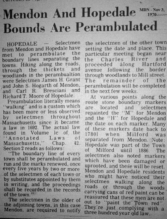
Perambulating the bounds is something that evidently is no longer done. Selectmen no doubt have more urgent matters to tend to than taking a walk in the woods. However, it was probably a good opportunity to compare notes with selectmen from neighboring towns. I haven't seen all the markers, but I'm thinking that the "1985" on one of the markers in Laurelwood, shown below, may have been the last time, or near to the last time it was done in this area. Thanks to DJ for assistance in locating some of the markers and taking several of the photos. Short Stories and Pictures Menu HOME |


This is a three-town marker. It's well into the woods, at the point where Hopedale, Mendon and Upton meet. Where's Carpenter Road? Click on the picture to see more of it. |

online for the town of Stow, posted for 2011. Residents are welcome to join the Board of Selectmen and their representatives as they walk and mark the Town Boundaries. State law requires that towns visit and mark their boundaries every five years. Stow's 2010 perambulation began in April 2010, and is being continued this year. Most, but not all, of the boundary markers are near a road. There will be some walking through woods and brush, so wear appropriate footwear and clothing for mud and ticks. A Wikipedia page on the practice tells mainly about it in England, where it's referred to as "beating the bounds." It says that in the U.S., it has been done in Massachusetts and New Hampshire. In England the custom dates from Anglo-Saxon times, as it is mentioned in laws of Alfred the Great and Æthelstan. It is thought that it may have been derived from the Roman Terminalia, a festival celebrated on February 22 in honour of Terminus, the god of landmarks, to whom cakes and wine were offered, sports and dancing taking place at the boundaries. Similar practices, of pagan origin, were brought by the Vikings. In England a parish-ale, or feast, was always held after the perambulation, which assured its popularity, and in Henry VIII's reign the occasion had become an excuse for so much revelry that it attracted the condemnation of a preacher who declared "these solemne and accustomable processions and supplications be nowe growen into a right foule and detestable abuse." More at http://en.wikipedia. org/wiki/Beating_the_bounds The following is from the New Hampshire Local Government site. Today's statutes have their roots in the Colonial Laws of the Massachusetts Bay Colony, which, as referenced in The Colonial Laws of Massachusetts, by William H. Whitmore, as early as 1651 required that: ...every Town shall set out their Bounds, within twelve months after their Bounds are granted: and that when their Bounds are once set out, once in three years, three or more persons of a Town, appointed by the Select men, shall appoint with the adjacent Towns, to go the Bounds betwixt their said Townes and renew their marks; which marks shall be a great heap of stones, or a Trench of six foot long and two foot broad, the most ancient town to give notice of the time and place of meeting for this perambulations; which time shall be in the first or second month, upon pain of five pounds for every Town that shall neglect the same.... There's much more on perambulation on that site at http://www.nhlgc. org/publications/item_detail.asp?TCArticleID=350 |
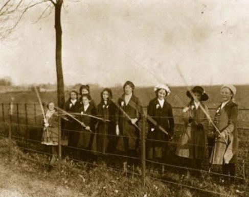
Perambulating the bounds in Boston - 1896 |

Hopedale Town Report - 1886 Surveying, Alton Cook, running boundary line, etc . $105.10 Crofton, Geo., cutting stone bound 10.00 |

While the Wikipedia article states that in the U.S., perambulating the bounds was done only in Massachusetts and New Hampshire, here's an article about it in Connecticut.
Guilford and Branford (Connecticut) walk their common town boundaries. They are reviving one of the state's earliest laws, ``An Act for Ascertaining the Bounds of Towns and the Lands of Particular Persons,'' which dates from 1650. They started their walk Fridayand will finish it later this week. "Perambulating the bounds,'' as the law was commonly called, required town officials to inspect their boundaries, paying special attention to property that straddled town lines so that taxes could be assessed by the correct municipality. By the time the state legislature repealed the law in 1979, town assessors relied on aerial maps to keep track of taxable property. Still, a boundary walk was used to settle a dispute in northeastern Connecticut in 1991. The walks along Branford and Guilford's common boundary are purely for fun, said Anthony DaRos, Branford's first selectman. In fact , the walks are a welcome break from his daily duties, he said. He and Samuel Bartlett, Guilford's first selectman, stood on a dike over Stony Creek and gazed at the salt grass toward Long Island Sound. They walked past a stone ledge that gave Stony Creek its name and another ledge containing former Indian caves. They peered into one of the stone quarries and wondered how deep it was. When the act was law, town officials were required to inspect the bounds each year. The frequency of the walks was later changed to once every five years. At the end of each walk, officials etched their initials and the year in stones, which were piled in ravines or around the bases of trees to mark the boundaries. Chester Blomquist, a retired Branford teacher, discovered some of those ``selectmen's stones'' several years ago while hiking the town's 28-mile perimeter with the Branford Walkers, a group he organized in 1987. After that, Blomquist invited Branford's different first selectmen to join the walkers on the group's perambulations. This is the first time that he and the two first selectmen are walking the bounds. They walked with other hikers for about three hours last week, which took them about halfway along the common boundary. They plan to complete their inspection Friday during a walk that will take them past a display of selectmen's stones in Westwoods Trail forest, where DeRos and Bartlett plan to carve their own stone records. During their first walk together, DaRos held a piece of granite in his hand. Pink granite used in the Statue of Liberty’s pedestal was quarried here, he said. In fact, a former quarry proprietor from Guilford was responsible for the most recent change to the towns' common boundary, said Joel H. Helander, Guilford's town historian. John Beattie, of Beattie Granite Quarry, successfully petitioned the legislature in 1885 for the right to pay taxes in one town, Helander said. His petition led to Guilford's border being extended westward to Hoadley Point, just east of Branford's Thimble Islands. Recently, a similar dispute involving a housing subdivision led to a change in the boundary shared by Ashford and Willington in the state's northeast corner. The legislature voted in 1991 to annex land to Willington after Ashford's town assessor, Emily Kasacek, discovered that the towns' boundaries did not match up on different maps. Here are a few more sites on perambulating the bounds. http://www.cholesbury.com/beatbounds.htm http://www.pastpresented.ukart.com/eskdale/peramb1793.htm Perambulating in Dublin |
A Grand Tradition: `Perambulating The Bounds' Town Boundaries Get Once-over April 23, 1998 By JANE E. DEE; Courant Staff Writer |
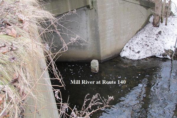
at the Milford line
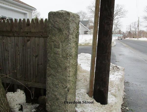
at the Mendon line