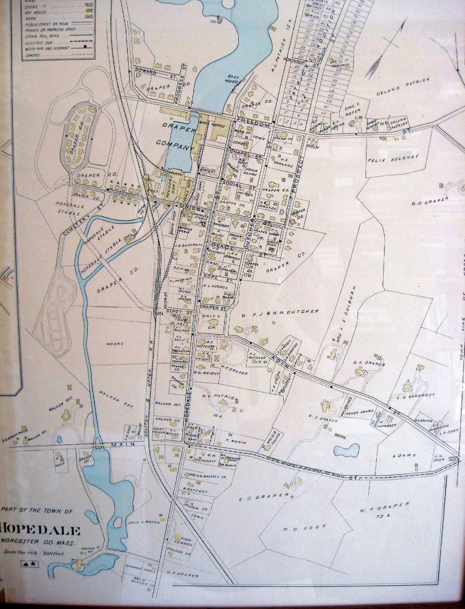
| Hopedale 1898 You can find a number of differences on this map from present day Hopedale. There was a bandstand behind the Town Hall. The park didn't exist, the area being divided into house lots and referred to as Patrick's Addition. Prospect Street went across Freedom through what is now the park. You could go from Union Street to Bancroft Park. The "Lower Pond," south of Freedom Street, [where it says Draper Company on the map] hadn't been filled in and built over. The houses on Union Street, west of the railroad tracks, all have little buildings behind them. Looks like the sewage system hadn't been extended to that neighborhood. The long-gone octagon house was still on Prospect Street. Take a close look and you'll probably find more items of interest. Click here to see an enlarged version of the Red Shop area. Click here to see a picture of the center of Hopedale taken within a few years of the time this map was drawn. 1916 Map Map Menu Red Shop Menu HOME |