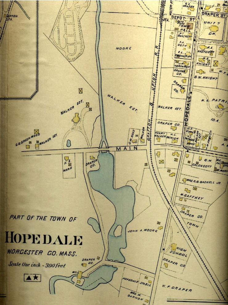
This is part of a map drawn c. 1898. The road that crosses the Mill River near the bottom is Thwing Street. The river between Route 16 (Main Street on this map, later renamed Mendon Street) and the area at the bottom of the map was quite different than it is now. The dam for the mill was removed long ago and now we see just a narrow river where the millpond once was. Click here to see the remains of the mill site. |