The picture on the lower right of the map above shows a building that may have been, in part, anyway, the Little Red Shop. This picture is in a Cotton Chats aricle that reports that it is the Red Shop. It doesn’t look at all like it, unless the front part was eventually demolished and the ell projecting at the right is what remains. Here is a link to the Cotton Chats aricle. About halfway down the page I’ve put my guess about that picture said to be the Red Shop, although it certainly looks much different from what we see now and from any pictures of it going back more than a century.
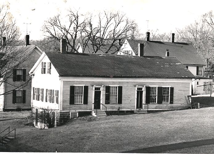
As to the picture on the lower left, what is it? It looks something like the first church built on the site of the present Unitarian Church, but the original one there was built in 1860. Also, it didn’t have a clock tower. See further down this page for an explanation of what the picture was probably showing.
The map is from the 2010 edition of Adin Ballou’s History of the Hopedale Community.
Here, on Hopedale Street, between Freedom and Chapel streets, stood the building that was the school and chapel at the time the map on this page was drawn. Evidently it had a clock tower on it originally, which was removed after the building was no longer used as the school and chapel. In Frank Dutcher’s memories of Christmas in early Hopedale, he mentioned that Almon Thwing had made a clock that was on the roof of the Community chapel/school. It seems likely that after that building was no longer used for its original purpose,Thwing moved the clock to his barn.Thomas Gaffney recalled that, “When Almon Thwing lived at the corner of Hopedale and Hope streets he had a large clock on the front of his barn. It was the only clock of its size in town and everybody referred to it as the Town Clock. It was built and maintained by Mr.Thwing with a great deal of pride.” It seems that when the clock was removed from the school/chapel, Thwing put it on his barn.